June 29 2010 – The Environment and Conservation Association on the East Rand has lodged a law-suit against SA's Minister of Water Affairs and President Jacob Zuma for ignoring the requirements of the Water Act as well as the Constitution regarding the dismal state of Hartbeespoort Dam.
 1,770-km Limpopo River basin endangered:
This is the primary fresh-water source for the Gauteng province. The rapid pollution of this entire riverine system also affects the entire 1,770-km long southern African Limpopo River Basin. Many tens of millions of people, most without fresh-water reticulation systems, rely solely on this water-basin for all their fresh-water needs.
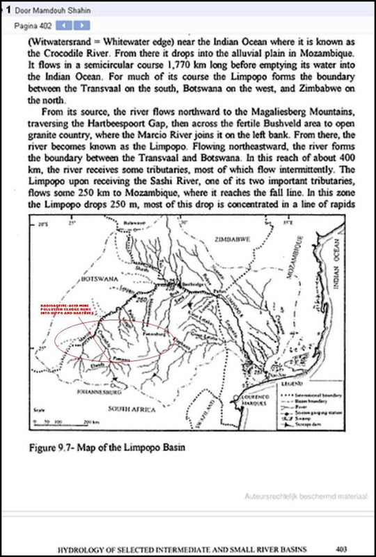
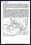 The map, left (the enlarged map is reproduced below this article) of the Limpopo Basin shows that the acid-radioactive waste sludge from the West Rand mines is polluting the source of the entire riverine system. The hippo herds in the Hippo Dam also are endangered.
Ms Nicole Barlow, chairwoman of the Environment and Conservation Association, said the SA government has for years allowed the uncontrolled spillage of heavily-polluted acid mine-runoff sludge (containing toxic and radioactive heavy metals) of up to 60 megalitres per day - (1 ML =1 million litres) into the Hippo Dam -- which is the first receptor dam within the Tweelopiespruit spilling its water into the Hartbeespoort dam.
Barlow told the local MadibengPulse newspaper editor Cynthia Dreyer in Magaliesburg that the Association gets involved in any such pollution problem in the country.
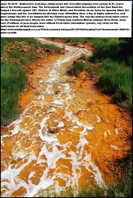
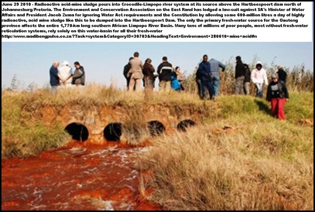
Alarming photos sent to MadibengPulse this week by Ms Mariette Liefferink, CEO of the Federation For A Sustainable Environment, show more dramatically than any words exactly what dangers lurk in the waters flowing into Hartbeespoort Dam, writes Dreyer. “In this case it’s in the Tweelopiespruit (left) which runs into the Crocodile River.
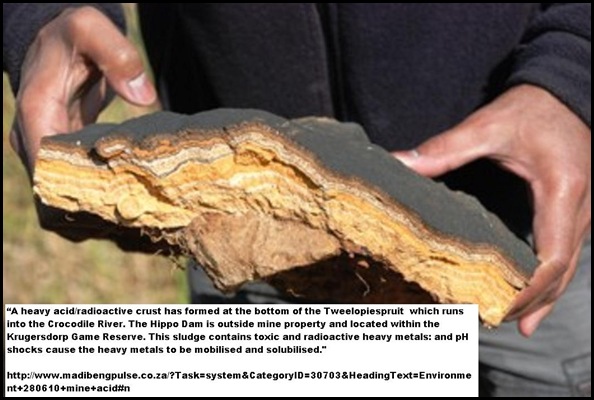
 “The Hippo Dam is outside mine property and located within the Krugersdorp Game Reserve. This sludge contains toxic and radioactive heavy metals: and pH shocks cause the heavy metals to be mobilised and solubilised.
“The Tweelopiespruit is one of the sources of the Crocodile River System and of the entire Limpopo River Catchment area.
“The photographs show the heavy crust of precipitated heavy metals which has formed on the bottom of the Tweelopiespruit.
http://www.madibengpulse.co.za/?Task=system&CategoryID=30703&HeadingText=Environment+280610+mine+acid#n
The pollution of the source of this very delicate riverine system affects the entire 1,770km-long southern African Limpopo River basin.
Many tens of millions of people in four countries rely on the Limpopo River basin water
And many tens of millions of people in four countries – Botswana, Zimbabwe, South Africa and Mozambique, rely solely on this water-basin for their fresh-water supplies.

This important Southern African river system – known as the Crocodile River at its source and the Limpopo at its outflow into the Indian ocean -- flows from the Witwatersrand high plains, drops into the alluvial plain in Mozambique on its semicircular 1,770-km course before emptying as the Limpopo river into the Indian Ocean.
Acid-radioactive crust at the bottom of the Tweelopies Spruit:
For much of its course the Limpopo forms the boundary between the Transvaal/Gauteng region in the south, Botswana on the west, and Zimbabwe on the north. From its source, the river flows northward to the Magaliesberg Mountain (Madibeng/Brits) – traversing into the Hartbeespoort gap, across the fertile Bushveld area to where the Marcio River joins it on the left bank.
From there the river becomes known as the Limpopo. In this reach of about 400km, the river receives some tributaries, most of which flow intermittently depending on the scarce rainfall pattern of southern Africa.
No comments:
Post a Comment
Note: only a member of this blog may post a comment.